Dinetah Archaeology
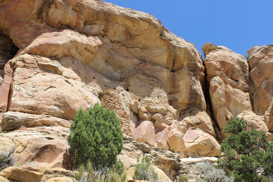
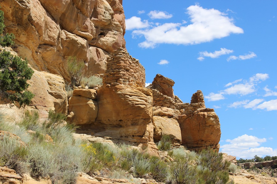
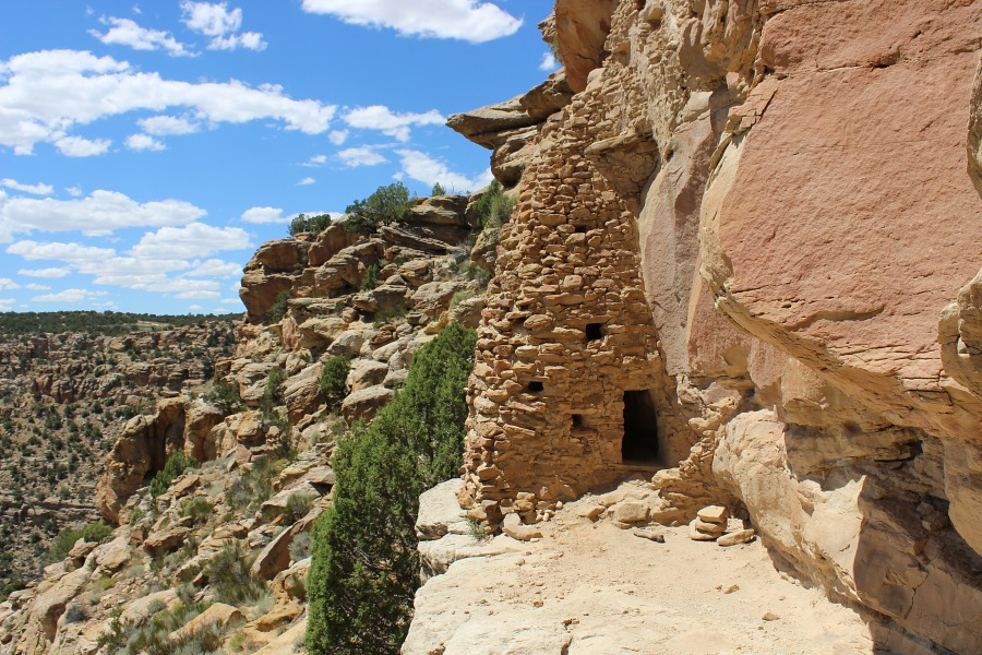
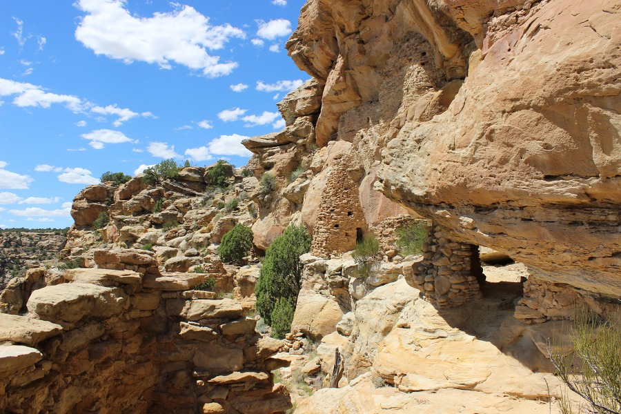
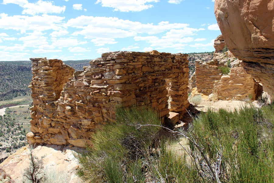
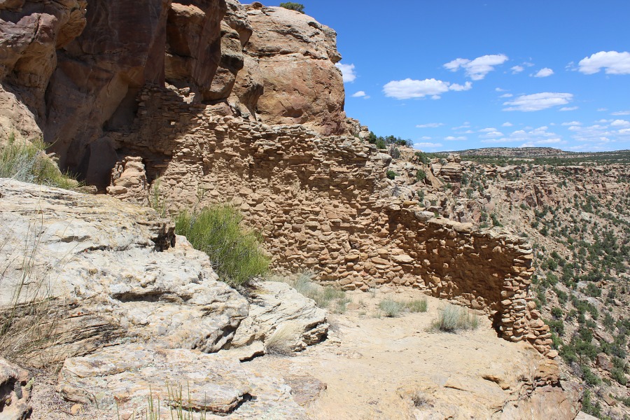
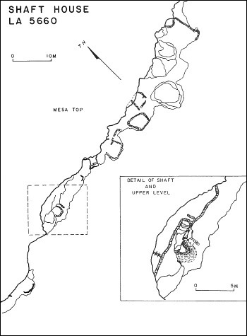
Shaft House Pueblito
Ceramic Assemblage: Currently only Dinetah Gray ceramics have been documented at the site (Towner 1997).
Tree-ring Analysis: Only nine tree-ring samples have been collected from the site. Wood species was dominated by juniper with a single sample of cottonwood. All of the juniper samples exhibit metal ax modification. Dates obtained from the juniper samples were inconclusive and only a post-1712 site occupation could be determined (Towner 1997).
| Land Owner: | Bureau of Land Management |
| Site Elevation: | 6483 ft / 1976 m |
| Hiking Difficulty: | Very Difficult =
Someone in excellent hiking condition; Distance greater than 1 mile; Elevation gain 300-400 feet. |
| References: | |
 |
Powers, Margaret A. and Byron P. Johnson 1987
Defensive Sites of Dinetah. New Mexico Bureau of Land Management Cultural Resources Series No. 2, 1987. U.S. Dept of the Interior, Bureau of Land Management, Albuquerque District. |
 |
Towner, Ronald H. 1997
The Dendrochronology of the Navajo Pueblitos of Dinetah, PhD dissertation, University of Arizona. |
More Information
Other Pueblitos
| ➠ Return to Archaeology Page |
Report Vandalism
Report any vandalism to the Bureau of Land Management hot line at (505) 564-7600.For in progress incidents, request a BLM Ranger through Non-Emergency Dispatch (505) 334-6622.