Dinetah Archaeology
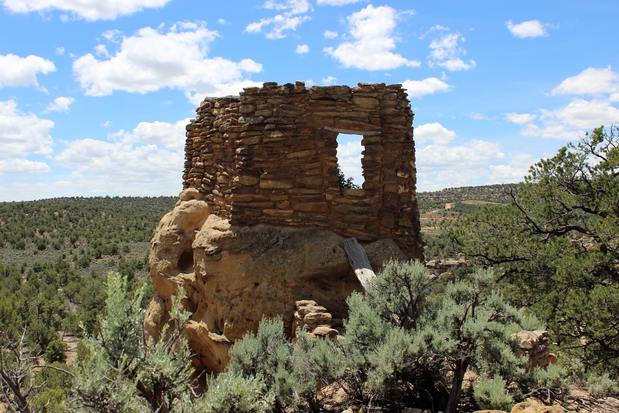
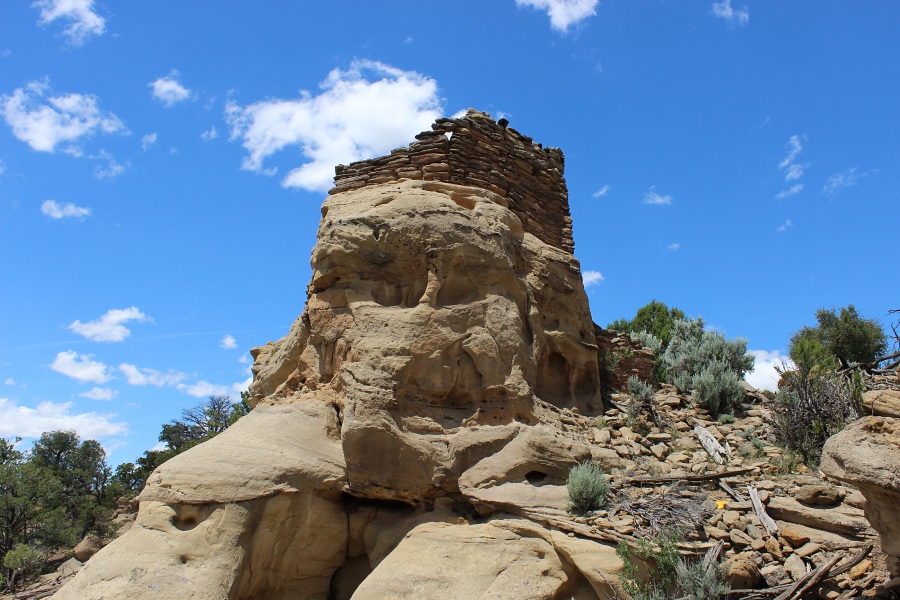
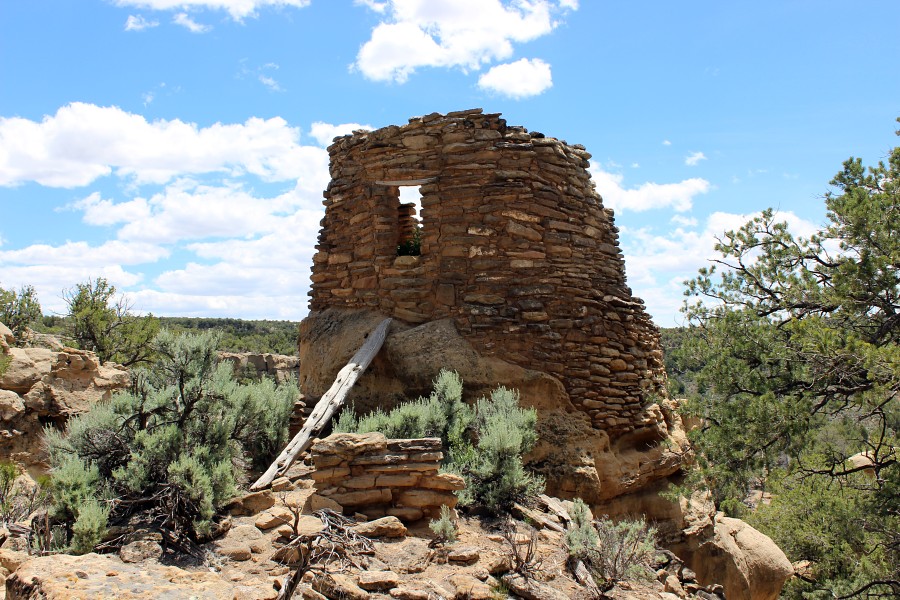
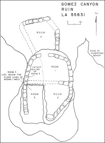
Gomez Canyon Pueblito
Ceramic Assemblage: Currently only Dinetah Gray ceramics have been documented at the site.
Tree-ring Analysis: Thirty-one tree-ring samples have been collected from the site, 22 from the masonry pueblito and nine from the hogans. Wood species included juniper and pinyon and metal ax use was observed on all the samples. Tree-ring dates from the site can be interpreted in several ways, however the most plausible seems to suggest that the pueblito was built sometime around 1735. Samples from the hogans indicate that they were likely contemporaneous with the pueblito (Towner 1997).
| Land Owner: | Bureau of Land Management |
| Site Elevation: | 6620 ft / 2017 m |
| Hiking Difficulty: | Easy =
Someone in fair hiking condition; Distance less than 500 ft; Elevation gain less than 50 feet. |
| References: | |
 |
Powers, Margaret A. and Byron P. Johnson 1987
Defensive Sites of Dinetah. New Mexico Bureau of Land Management Cultural Resources Series No. 2, 1987. U.S. Dept of the Interior, Bureau of Land Management, Albuquerque District. |
 |
Towner, Ronald H. 1997
The Dendrochronology of the Navajo Pueblitos of Dinetah, PhD dissertation, University of Arizona. |
More Information
Other Pueblitos
| ➠ Return to Archaeology Page |
Report Vandalism
Report any vandalism to the Bureau of Land Management hot line at (505) 564-7600.For in progress incidents, request a BLM Ranger through Non-Emergency Dispatch (505) 334-6622.