
Dinetah Archaeology
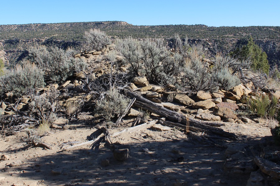
Adams Canyon Pueblito
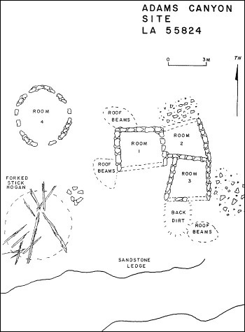
Ceramic Assemblage: Ceramics documented at the site included Dinetah Gray and Gobernador Polychrome.
Tree-ring Analysis: Five tree-ring samples have been collected at the site, four from loose logs around the room block and one from the hogan. Wood species of juniper and pinyon were identified and metal ax use was also observed. None of the samples provided cutting dates and because of weathering, absolute dating is limited. At best, it appears that the pueblito was built sometime after 1736 (Towner 1997).
| Land Owner: | Bureau of Land Management |
| Site Elevation: | 6551 ft / 1997 m |
| Hiking Difficulty: | Moderate =
Someone in good hiking condition; Distance about 1/4 mile; Elevation gain less than 50 feet. |
| References: | |
 |
Powers, Margaret A. and Byron P. Johnson 1987
Defensive Sites of Dinetah. New Mexico Bureau of Land Management Cultural Resources Series No. 2, 1987. U.S. Dept of the Interior, Bureau of Land Management, Albuquerque District. |
 |
Towner, Ronald H. 1997
The Dendrochronology of the Navajo Pueblitos of Dinetah, PhD dissertation, University of Arizona. |
More Information
Other Pueblitos
| ➠ Return to Archaeology Page |
Report Vandalism
Report any vandalism to the Bureau of Land Management hot line at (505) 564-7600.For in progress incidents, request a BLM Ranger through Non-Emergency Dispatch (505) 334-6622.