
Dinetah Archaeology
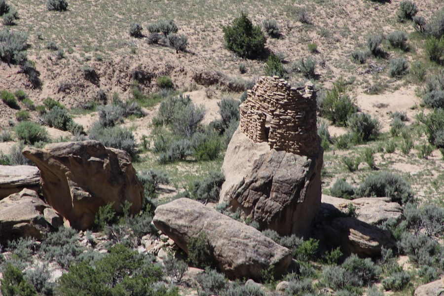
Foothold Pueblito
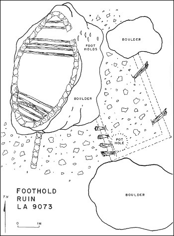
Ceramic Assemblage: Ceramics documented included Dinetah Gray, Gobernador Polychrome, Jemez Black-on-white, and Zia, Santa Ana, Tewa, Hopi, and Zuni wares (Towner 1997).
Tree-ring Analysis: Thirty-nine tree-ring samples have been collected from this site. Wood species included juniper, pinyon, and cottonwood. Majority of the samples had evidence of metal ax use. Though numerous tree-ring samples had been collected, few resulted in cutting dates. Results suggest a construction date for the pueblito sometime after 1739 (Room 2) and 1740 (Room 1). Tree-ring samples taken from one of the hogans indicates a date sometime after 1710 (Towner 1997).
| Land Owner: | Bureau of Land Management |
| Site Elevation: | 6340 ft / 1932 m (estimated) |
| Hiking Difficulty: | Access to the site is problematic as it requires traveling through private property. The site can be viewed from above from Overlook Pueblito. |
| References: | |
 |
Powers, Margaret A. and Byron P. Johnson 1987
Defensive Sites of Dinetah. New Mexico Bureau of Land Management Cultural Resources Series No. 2, 1987. U.S. Dept of the Interior, Bureau of Land Management, Albuquerque District. |
 |
Towner, Ronald H. 1997
The Dendrochronology of the Navajo Pueblitos of Dinetah, PhD dissertation, University of Arizona. |
More Information
Other Pueblitos
| ➠ Return to Archaeology Page |
Report Vandalism
Report any vandalism to the Bureau of Land Management hot line at (505) 564-7600.For in progress incidents, request a BLM Ranger through Non-Emergency Dispatch (505) 334-6622.