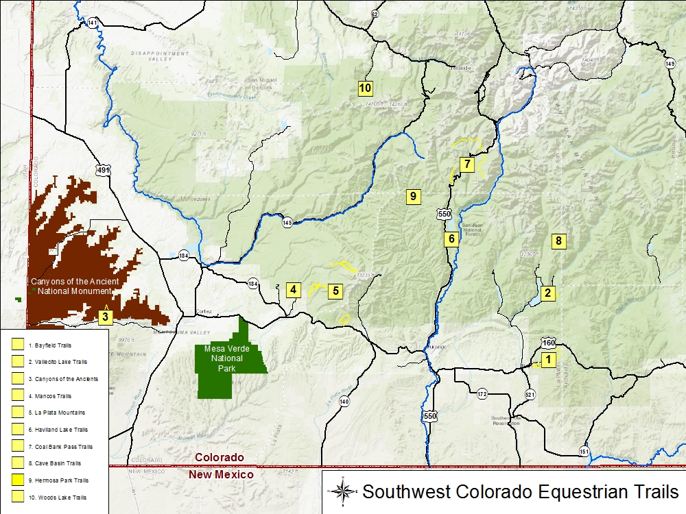
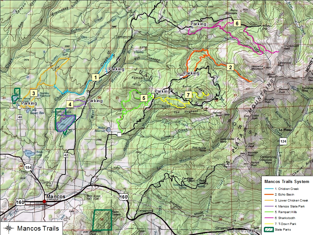
To date, there are three major trails recorded north of Mancos on the western slopes of the La Plata Mountains that are feasible for horse riding.
Trail Name
Miles
Elevation
1. Chicken Creek 615
12.0
8,360-9,270 ft
2. Echo Basin
15.6
8,360-9,270 ft
3. Lower Chicken Creek
9.1
7,680-8,360 ft
4. Jackson Gulch-Muleshoe Loops
7.6
7,800-8,240 ft
5. Rampart Hills
10.4
8,120-9,280 ft
6. Sharkstooth
15.7
9,625-11,942 ft
7. T-Down Park
7.6
9,060-10,460 ft
1. Chicken Creek 615
Trail head starts at a parking spot at Doc Lowell Flat. This is a single-track, out and back trail with numerous ups and downs and twists. For mountain bikes it is more technical due to rocks and roots. The ride will take you through mixed aspen, Gamble oak, and patches of ponderosa pine. The trail ultimately connects with Connector 177 which will connect you with the North Loop of Lower Chicken Creek Trail.
2. Echo Basin
Trail head starts at a parking spot off of Forest Rd 331 (aka Echo Basin Rd) by some corals. The ride will take you through mixed aspen, Gamble oak, and patches of ponderosa pine.
3. Lower Chicken Creek
Trail head starts near Joe Moore reservoir and heads northeast to form two distinct loops. This is mostly a two-track road with parts graveled. Often used in winter for cross-country skiing. The ride will take you through tall ponderosa pine.
4. Jackson Gulch & Muleshoe Loops
Located within the Mancos State Park (Jackson Gulch Loop) and San Juan National Forest (Muleshoe Loop) on the western slopes of the La Plata Mountains, the trail head for these trails is best accessed off of County Road 42 near the Muleshoe trailhead. The ride will take you through mixed aspen, Gamble oak, and patches of ponderosa pine.
5. Rampart Hills
Assessable off of CR 44 (Echo Basin Road) and within the San Juan National Forest, Rampart Trails traverses the southern foothills of Rampart Hills on the western slopes of the La Plata Mountains. The trails are part jeep and single track and also utilized by mountain bikes. The ride will take you through mixed aspen, Gamble oak, ponderosa pine, and clusters of spruce.
6. Sharkstooth
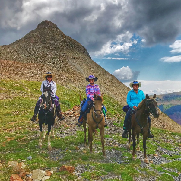
Assessable from the town of Mancos via CR 42 ((W Mancos Rd) and Spruce Mill Road, the Sharkstooth Trail lies within the San Juan National Forest. The trail is predominately single track from the parking area to Sharkstooth Pass which is located south of Sharkstooth Peak. A portion of the trail ride will follow a 4-wheel drive road often traveled by hikers seeking to hike the last 2 mile segment to Sharkstooth Pass or Peak. The trail will take one through mixed aspen, spruce, and alpine meadows. Spotted areas of rocky talus, hoof protection or shoes is highly recommended.
7.T-Down Park
Assessable off of CR 44 (Echo Basin Road) and within the San Juan National Forest, T-Down Park Trails traverses the southern slopes of Burnt Ridge on the western slopes of the La Plata Mountains. The trails are part jeep and single track and also utilized by mountain bikes. The ride will take you through mixed aspen, Gamble oak, ponderosa pine, and clusters of spruce.
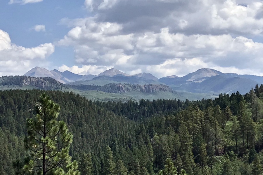
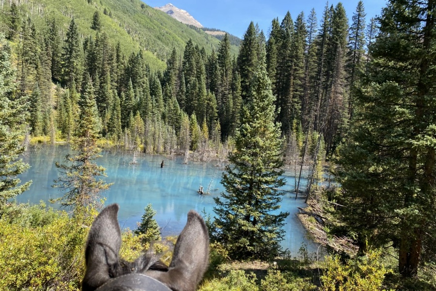
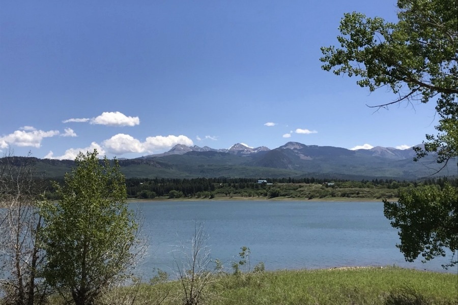
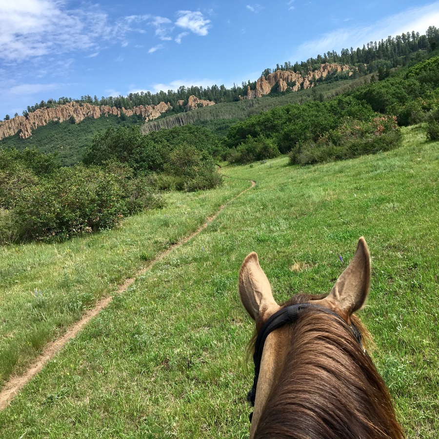
View of Ramparts & Hesperus Peak on the Connector 177 Trail.Beaver Pond, Hesperus Peak in Background.View of Jackson Gulch Reservoir.Ramparts trail.Sharkstooth Peak in the background.
Photos by Cathy Cumberworth, Click Photo to Enlarge.