White Rock Trails

Trail Courtesy Yield To
In and around Los Alamos, New Mexico are a palethera of trails for the hiking enthusiast. Many of the trails are easily accessible within the town of Los Alamos and off of Hwy 4 which provides access to the Santa Fe National Forest. Majority of these trails are designated for foot use, however several trails can be used for mountain biking and horseback riding.

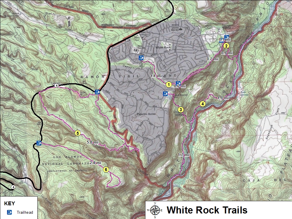
These trails are located east of Los Alamos within the White Rock community off of Hwy 4.
Trail Name Difficulty Distance Elev. Gain
1. White Rock Canyon Rim Easy 2.8 mi / 4.6 km 30 ft
2. Blue Dot Moderate 1.8 mi / 2.8 km 790 ft
3. Red Dot (Pajarito Springs Trail) Moderate 4.8 mi / 7.7 km 1,270 ft
4. River Trail Moderate 4.2 mi / 6.8 km 50 ft
5. Water Canyon Loop Moderate 5.8 mi / 9.4 km 600 ft
6. Powerline Point Easy 4.8 mi / 6.8 km 430 ft
White Rock Trails
White Rock Hiking Trails Map and Info (PDF 1.0 MB)