Crow Canyon Trails

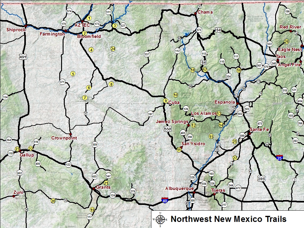
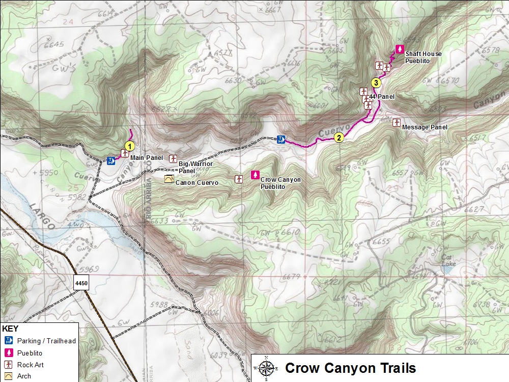
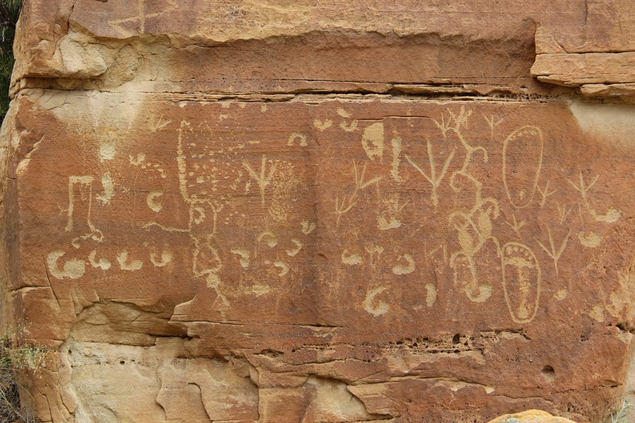
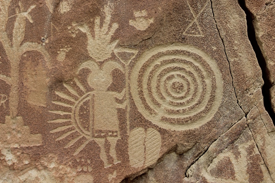
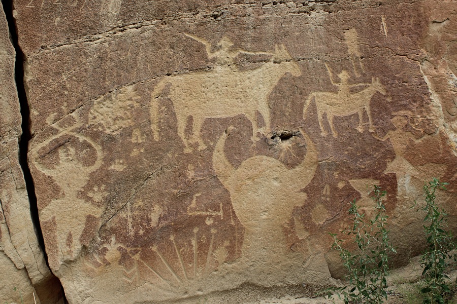
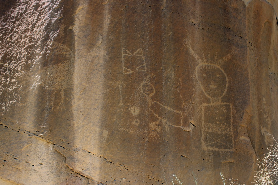
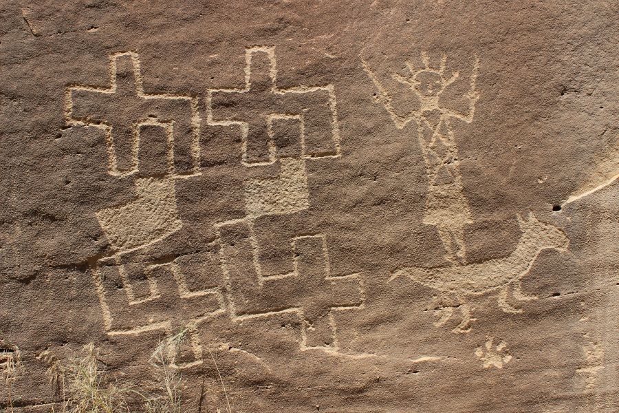
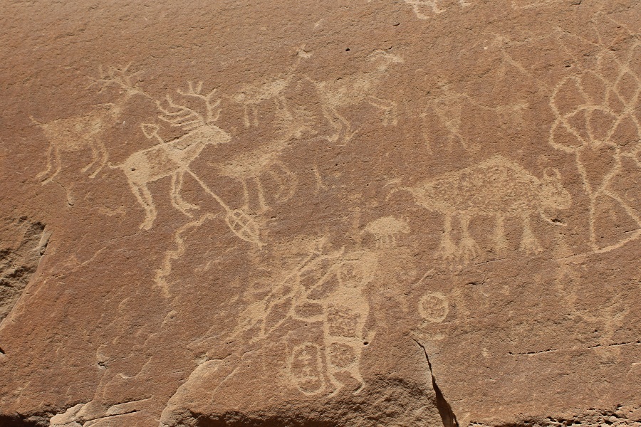
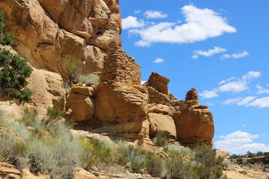
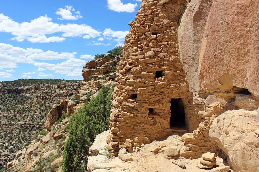
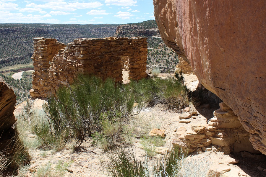
Located southeast of Aztec, NM, in the Largo Canyon region is the Crow Canyon National Register District. It is within this area that the Bureau of Land Management has identified pueblitos, cliff storage structures, and the best-known collection of 16th-18th century Navajo petroglyphs (carved rock art) in the American Southwest. In addition, earlier Ancestral Puebloan images can also be found among the Navajo rock art in Crow Canyon. Hundreds of images of animals, humans, supernatural beings, and other images such as corn plants and bows and arrows can be found. Most of the images are clustered in what are referred to as "panels," on the lower cliff faces of the canyon.
  • ➠ More About the Archaeology of Crow Canyon

  • Trail Name Difficulty Distance Elev. Gain
    1. Main Panel Trail Easy 0.6 mi / 0.8 km < 50 ft
    2. 44 Panel Trail Easy 1.6 mi / 2.6 km <50 ft
    3. Shaft House Moderate-Difficult 3.0 mi / 4.8 km >250 ft
    Crow Canyon Trails Map
    Crow Canyon Trails Map (PDF 814 KB)

    Crow Canyon
    First Navajo Panel on Main Panel Trail.
    Crow Canyon
    Main Navajo Panel on Main Panel Trail.
    Crow Canyon
    Main Navajo Panel on Main Panel Trail.
    Crow Canyon
    First Panel on the 44 Panel Trail.
    Crow Canyon
    The 44 Panel.
    Crow Canyon
    Third panel on the 44 Panel Trail.
    Crow Canyon
    Approach to Shaft House Pueblito.
    Crow Canyon
    Shaft House Pueblito.
    Crow Canyon
    Part of roomblock at Shaft House Pueblito.
    Photos by EMKotyk