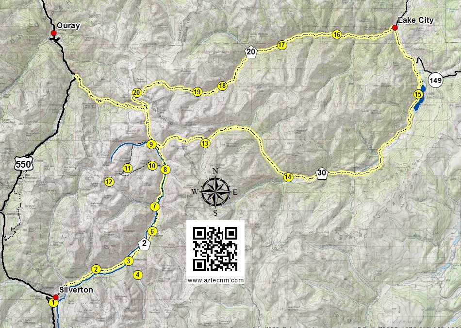
The Alpine Loop Scenic Byway is a 65 mile back country loop which traverses the remote, rugged, spectacular San Juan Mountains between Silverton, Lake City and Ouray, Colorado. Much of the loop requires a high-clearance 4-wheel-drive vehicle.
These rocky roads were first used by 19th-century miners, who carted their ore off to Silverton, Ouray, and Lake City in mule-drawn wagons. One can easily spend an entire day exploring the ghost towns, abandoned mining camps, and mining structures that were built from the mid-1870s to early 1900s.
Silverton
Silverton is a National Historic Landmark, home to Animas Forks and the Alpine Loop Scenic Byway, and the summer destination for the Durango & Silverton Narrow Gauge Railroad train ride.
Silverton is a recreational paradise in winter for snowmobiling, skiing, sledding, ice skating, ice climbing, and ice fishing, and in the summer for rafting, ATV and OHV riding, backcountry touring, fishing, hiking, biking, rafting, horseback riding, hunting, and camping.
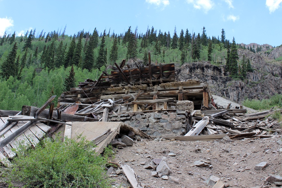
Old abandoned mine just south of Silverton.
Abandoned Little Dora Mine.
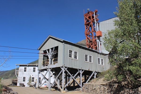
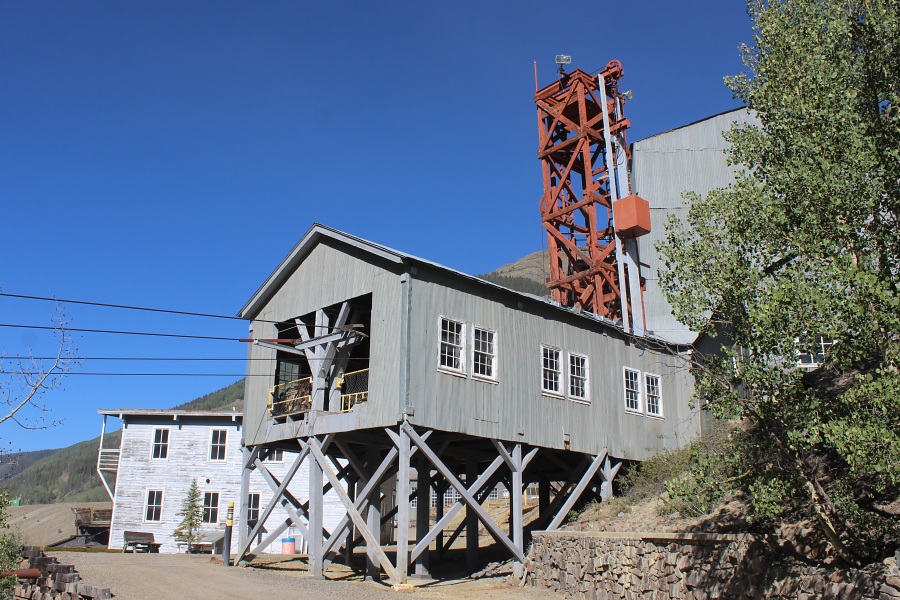
A National Historic Landmark, this wonderful piece of mining history is open to the public. The Mayflower Mill was the last and the most advanced of the big mills to be built in the San Juan Mountains. Take a self-guided tour and learn how the miners were able to extract gold, silver and base metals from the hard rock ores in this complete processing mill.
Located at the head of Cunningham Gulch, Howardsville was one of the largest and most prosperous towns in its time. Its first big strike was in 1874 by the Bullion City Company. Later that same year Bullion City was renamed to Howardsville, after its original founder George Howard. Howardsville was originally established as the county seat of San Juan County until 1875. As mining in the region diminished due to poor returns, most of the people moved to nearby Silverton and in 1939 Howardsville lost its post office. Today there are still a few remnant structures and a handful of residents in the area.
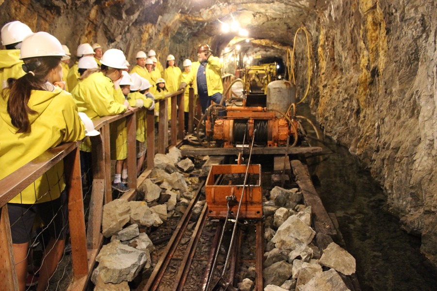
The Old Hundred Mine is a must visit on your trip along the Alpine Loop. This is an hour long tour that takes you 1/3 of a mile into the Galena Mountain. Visitors will learn about the history of the mine, mining in the region, and witness how some of the equipment was used to mine for gold and silver.
In 1875, the Ennis brothers paid a "spiritualist" to locate a mine for them. As a mining encampment, it had a post office from 1878 to 1885. In 1985 the Ennis brothers declared bankruptcy as the Highland Mary Mine failed to produce a return. By 1907, and under new ownership the mine paid off immediately and was the second largest mine in the Silverton area.
This town was named because it was in the middle between Howardsville and Eureka. The first claim was made in 1883 by two men named Gottlieb and Konneker. Over the years, Howardsville and Eureka grew so big it attracted those who lived in Middleton and the town died.
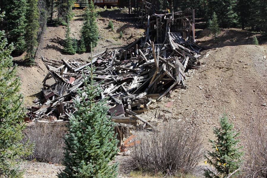
Collapsed structure.Photo by EMKotyk
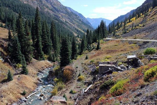
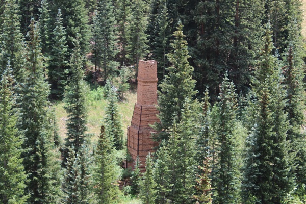
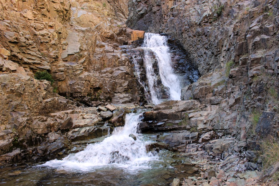
The town got its start in 1860 when a small group of miners began to dig and pan around the banks of the Animas River south of the mining town of Animas Forks. By 1875, a post office had been established, train service came in 1896, and Eureka boasted to have "the finest saloons anywhere" along the Animas River. However, in 1939 the Sunnyside Mill closed and the town soon became abandoned. Currently one building (the old jail which had been restored) and the remnants of the Sunnyside Mill and tram foundation along the mountainside is all that remains visible. There is a nearby primitive campground and one can hike into Eureka Gulch and see the falls of the South Animas River Fork.
Remnants of the Sunnyside Tram.Falls at Eureka Gulch.Eureka Gulch out towards Animas Valley.Photos by EMKotyk
One of numerous abandoned mines in the San Juan Mountains, this particular location also had a foot bridge which crosses the Animas River.
Remnants of an abandoned mine.Photo by EMKotyk
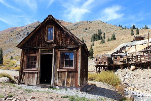
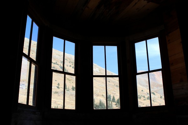
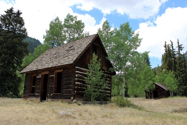
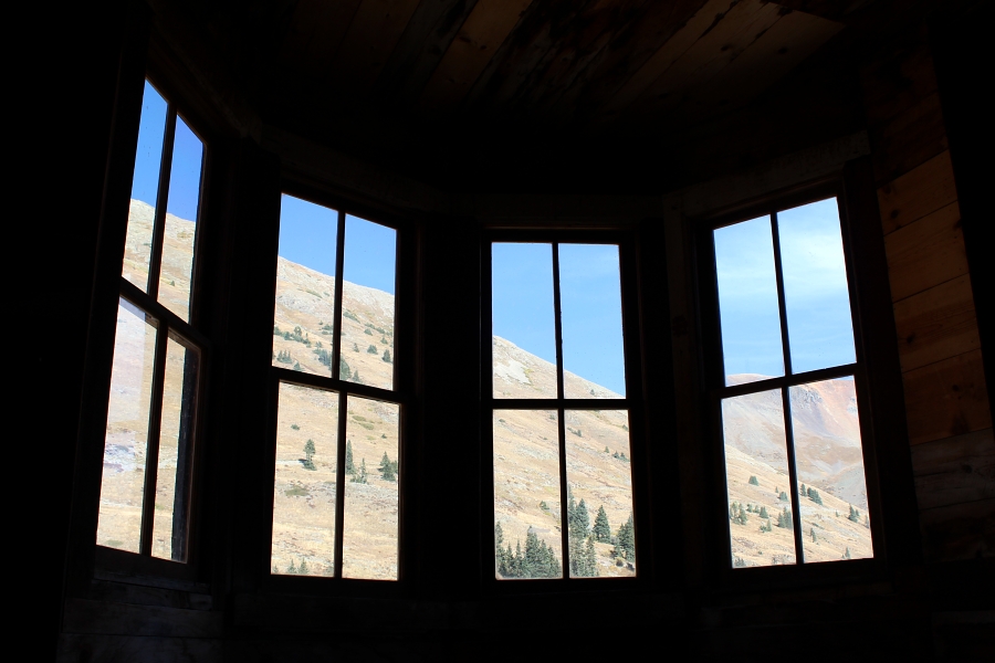
Near the fork of the Alpine Loop, lies the historic mining town of Animas Forks (originally named Three Forks). First established in 1873, this town boomed from 1876 to 1884. However, due to poor profits from mining ventures, the town declined over the years until 1904 when it rebounded with the construction of the Gold Prince Mill. Only a few of the original buildings remain in Animas Forks. The Gold Prince Mill was disassembled in 1910 and relocated to Eureka. Other town buildings were demolished by heavy snow or vandalism. The buildings that remain were stabilized or reconstructed to preserve the history.
Unnamed building at the road fork.Duncan House looking through the bay windows.The Carriage House.Photos by EMKotyk
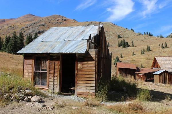
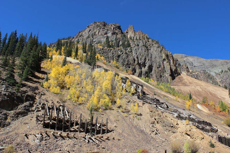
Treasure Mountain Mine has a multi-room building and stamp mill, however no equipment is left in the stamp mill.
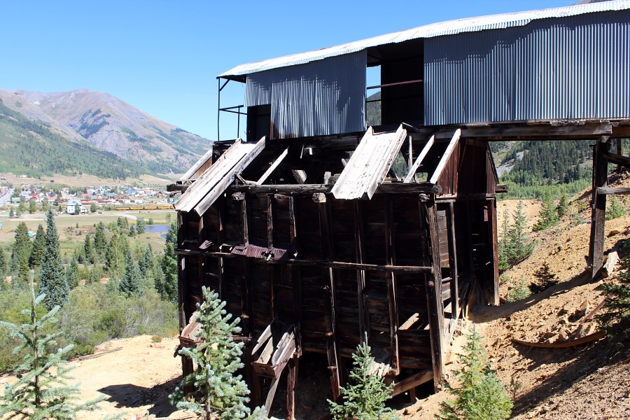
The Sound Democrat Mill is a seven stamp, five concentration table, ore-processing mill built in 1905- 1906, and remodeled in 1909. It is a typical amalgamation and concentration stamp mill built to treat gold and silver-lead ores. It is the last standing stamp mill in the productive Eureka district, and one of the most complete stamp mills remaining in Colorado.
At the height of mining activity in the late 1800's and early 1900's, the Sunnyside mine complex was a self-contained community complete with offices, boarding houses, hospital, and commissary. It was one of the most prosperous mines in the region, being owned by various companies and mined off and on until 1999. This mine is most famous for having broken and drained Lake Emma in 1978. Cleanup took nearly two years.
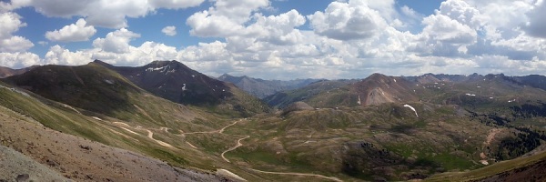
View to the east at Cinnamon Pass along the southern (CR 30) route of the Alpine Loop Scenic Byway. Elevation is 12,640 feet.
View to the east on Cinnamon Pass.Photo by EMKotyk
(The following info is from the BLM Interpretive Site Plaque)
Sherman was named for Sherman Williams who arrived in the upper Lake Fork of the Gunnison River drainage in 1875. Like so many other towns, Sherman grew quickly in the 1880s when veins of potentially profitable ore were located in the nearby mountains. The excitement of a new ore strike brought in a rush of people, all hoping to take part in the bonanza. Mines such as the New Hope, Smile of Fortune, and Minnie Lee yielded profitable deposits of gold, silver, copper, and lead.
By 1881, the town boasted economic prosperity with the opening of the Sherman House that provided, "Good accommodations for Travelers, Liquors, Wines, St. Louis Beer, and Cigars." The well-read Crofutt's Grip-Sack Guide to Colorado stated that a general store opened in Sherman the same year which "tempted the one hundred citizens to spend their money at home."
Railroad ties were cut from the forested hillsides for use on the Denver and Rio Grande Railroad. In 1895, William Peters floated 12,500 railroad ties down the river from Sherman to Lake City.
To reduce flooding and power the Black Wonder Mill, a 147-foot high dam was built on the Lake Fork of the Gunnison River. In 1921, the dam was torn apart by a flash flood and the raging waters destroyed most of Sherman.
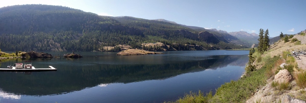
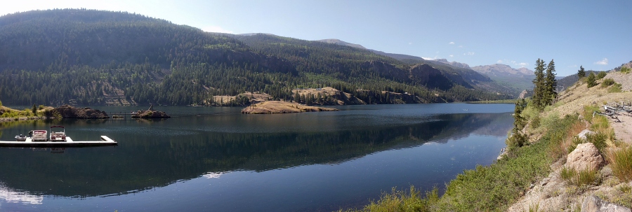
San Cristobal Lake
The second-largest natural lake in Colorado, Lake San Cristobal was formed by a rare natural earthflow called the Slumgullion Slide. Activities at the lake include camping, non-motorized boating, and fishing.
San Cristobal Lake.Photo by EMKotyk
Lake City
Lake City offers something for everyone. Things to do in the area include kid friendly activities, a wide range of outdoor recreation opportunities, nightlife, music shows, plays, historic tours, shopping, and plenty of winter sports such as back country skiing and snowshoeing, snowmobiling, ice climbing, and ice fishing.
(The following info is from the BLM Interpretive Site Plaque)
As the primary impetus of Lake City's initial boom and the mainstay of its survival through the mid-1900s, the Ute-Ulay Mine and Mill Complex is linked to Hinsdale's county seat and only incorporated town emotionally and irrevocably. Architecture preserved in Lake City's historic district harkens back to a time when miners came to town to spend their earnings, and mine owners, merchants and artisans worshipped, entertained, and plied their wares. The new production from the Ute-Ulay initiated the tipping point which finally brought the Denver & Rio Grande Railroad to Lake City in 1889. With the procession of owners who believed and invested in its possibilities, the mine and mill operation became the benchmark for resilience and the embodiment of Hinsdale County's character and promise.
Combining efforts saved one of the most intact, historical mining communities in Colorado. A partnership consisting of local government, a private mining company, nonprofit organizations, and state and federal agencies are transforming the Ute and Ulay mines, mill complex and surrounding Henson town site into a heritage tourism destination. Unique in its ability to educate and highlight the energy that drove decades of Southwest Colorado's "San Juan Excitement"; the Ute-Ulay not only provides a glimpse of our pioneer past, but a clue to the promising future of the Shining Mountains.
Henson / Ute-Ulay.Photo by EMKotyk
(The following info is from the BLM Interpretive Site Plaque)
George S. Lee arrived in Hinsdale County from Massachusetts in May, 1877 with ambitious plans for the newly formed Galena Mining District. Lee saw opportunities to invest in the future of Colorado. At the time, the two-hundred-acre town site known as Galena City had two stores, several hotels and restaurants, a post office, approximately one hundred houses (cabins), and the George B. Greene & Company Smelter. Galena
City was renamed Capitol City when the name Galena was selected by another community in Colorado.
In 1879, Lee built a two-story brick house that was advertised as the Mountain House Hotel. It included a formal living room, several guest bedrooms, and a formal ballroom with a glassed in bay window, in which tropical plants were grown. Governor F. W. Pitkin was an overnight guest in the home in 1879. Lee's vision did not stop with his residence. He built a carriage house for his buggy and a brick outhouse the first and only one of its kind in the region. He also built Henson Creek (Lee's) Smelter, Rose Lime Kiln, and a saw and planing mill. Lee delivered lumber and shingles to the mines using packjacks - a string of mules used to haul supplies.
Lee's holdings became insolvent in 1882 and he relocated to Denver. He later moved to New Jersey where he perfected and patented a number of inventions.
Remnants of Capital City.Photo by EMKotyk
(The following info is from the BLM Interpretive Site Plaque)
Rose Lime Kiln was built along the banks of Henson Creek in the spring of 1881 by local investor and businessman George S. Lee. At the time, Lee used rare technology that he believed would dramatically change construction material and development. Lee had lofty goals for the region and had already built several saw mills, lumber planning mills, a marble quarry, a brick factory, two smelters, and his distinguished Lee's Mansion in Capitol City.
Lime was highly desired as a flux for smelting and as a blending agent in cement. It was used in mortar to chink log cabins and in plaster for interior walls. Anticipating a building boom in Capitol City and Lake City, Lee hired local brick masons Samuel Tarkington to construct the kiln with bricks and steel. Limestone was mined from the adjacent Rose Lime Lode on Gravel Mountain and loaded into the top portal of the forty-four foot chimney. With temperatures ranging between 1000 and 1200 degrees centigrade, the limestone was reduced to lime and removed from the bottom portal. This "perpetual-feed kiln" produced high-quality lime that was free of ash impurities.
During its short period of operation in 1881 and 1882, Rose Lime Kiln produced 600 bushels of lime per day which sold for $1.00 per bushel. Although the kiln was a success, Lee did not anticipate the regional depression that hit the area in 1882. Lee's investments soon became insolvent so he sold his interests in Capitol City and moved to Denver.
Rosa Lime Kiln.Photo by EMKotyk
(The following info is from the BLM Interpretive Site Plaque)
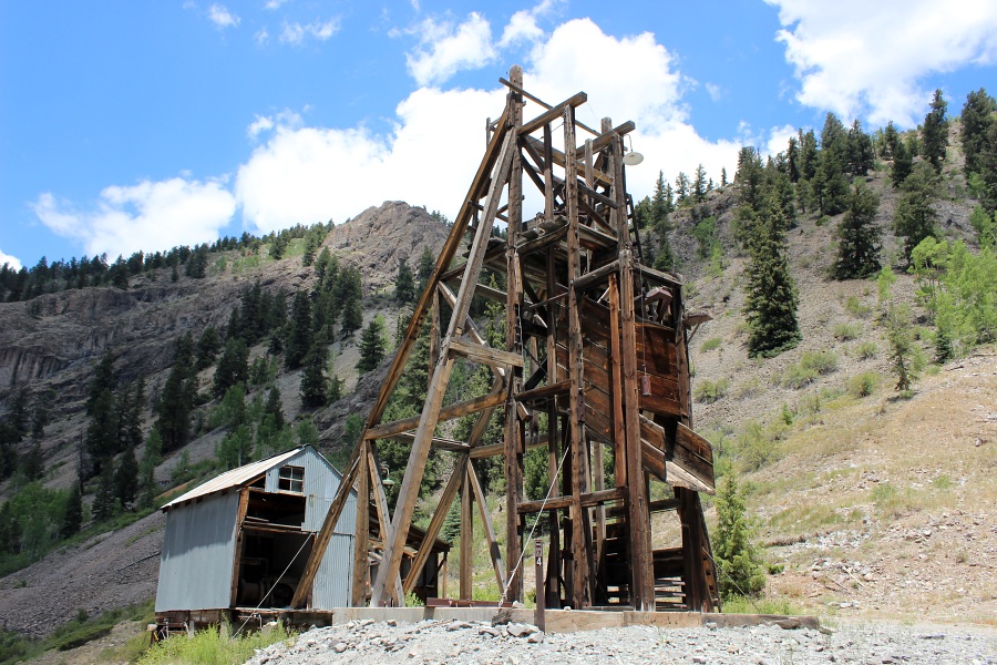
The history of the Bonanza-Empire Chief Mine and Mill mirrors the stories told of fleeting fortunes throughout the San Juan Mountains. The initial discovery of the Bonanza Lode was made on July 4, 1885. Little work was completed on the claim until 1901 when the Henson Creek Lead Mines Company issued $1.500.000 in Capital Stock and began constructing the three-story concentration mill. Over the next few years, little underground work was performed yet above-ground facilities were developed including an electric power plant, a boarding house, and a blacksmith shop. At the same time bonds were Issued to raise funds needed to cover
mounting debts. In 1906, over 3,700 feet of drifts were driven into the mountain as miners followed promising veins or ore that contained galena, zinc, silver, and gold. Unfortunately, as was often the case in hard rock mining, the promise of fortune was
short-lived and the mine once again shut down in 1907.
The Bonanza Empire Chief experienced a brief revival in the 1920s when the mill was retooled: however, little high-quality ore was produced. In 1929, the mill was once again reworked, but low ore values, rising coal prices, legal battles, transportation problems,
national financial problems, and a devastating avalanche forced the mine to close. The Bonanza Empire Chief Mine and Mill was eventually liquidated In a series of' Sheriffs Sales.
The mill had been stabilized in 2000 by the Bureau of Land Management and the Hinsdale County Historical Society. However in February 2008, the mill was destroyed by an avalanche.
Bonanza Empire Chief mine.Photo by EMKotyk
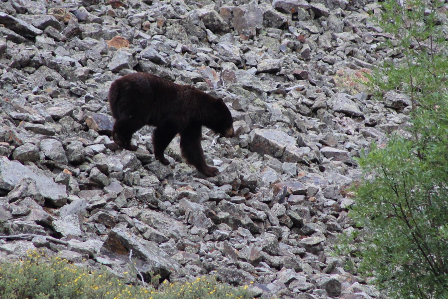
Sighting of a bear along the talus slopes when driving along CR 20 towards Engineer Pass.
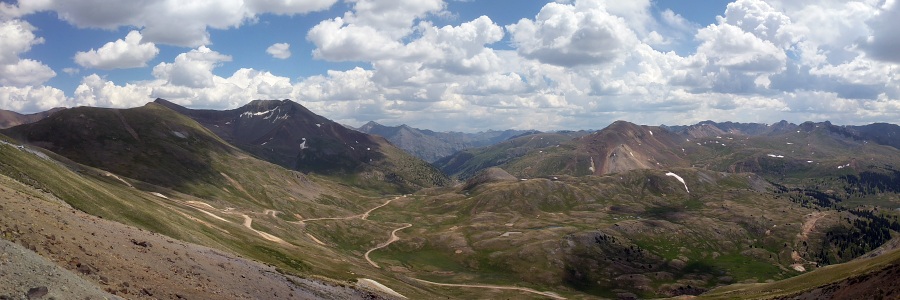
View to the west from Engineer Pass along the northern (CR 20) route of the Alpine Loop Scenic Byway. Elevation is 12,800 feet.
View to the west on Enginner Pass.Photos by EMKotyk
Ouray
Nicknamed "Switzerland of America," Ouray has been a world-famous destination for more than 100 years. Ouray features a heavenly hot springs, Box Canyon Falls, and a super-popular July 4th celebration.