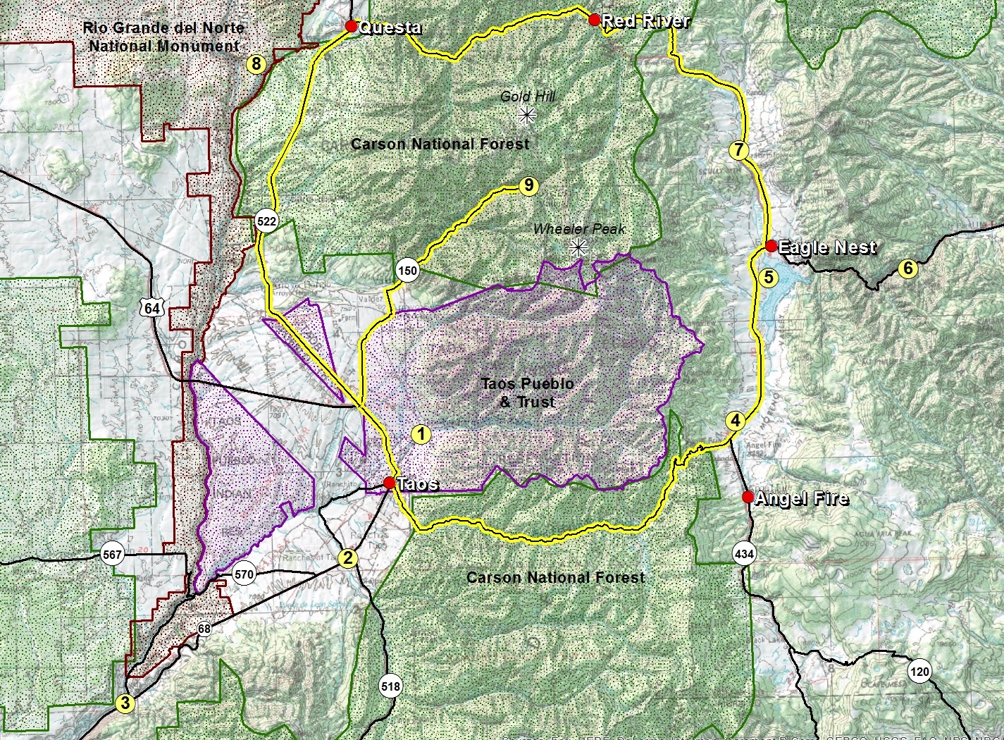
This scenic byway follows historic U.S. 64 from Taos through Angel Fire and into Eagle Nest; then onto N.M. 38 to Red River and Questa; and then on N.M. 522 to Taos. The scenic byway forms an 85 mile loop which takes one through mountains, valleys, mesas, and national forest all unique to Northern Central New Mexico. A side detour on N. M. 150 through Arroyo Seco (an artist community) to Taos Ski Valley will add another 30 miles round trip.
Taos
As one of America's foremost, bona fide Art Colony's, Taos is also home to a world-class ski resort (Taos Ski Valley), a World Heritage Site (Taos Pueblo), one of the most photographed and iconic churches (St. Francisco de Asis), and a majestic landscape encompassing the Rocky Mountains and the Rio Grande Gorge. Taos is a community overflowing with a long proud history, three cultures living side by side, and a heritage of colorful people. There is a plethora of things to see and do in Taos. With plenty of art and craft boutiques, outdoor recreational rentals, and numerous historic sites and museums, a visitor needs more than a weekend stay.
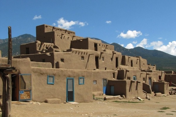
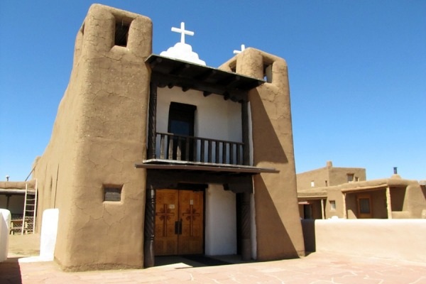
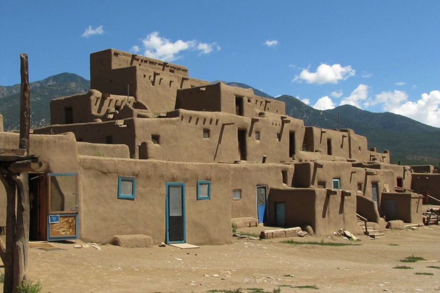
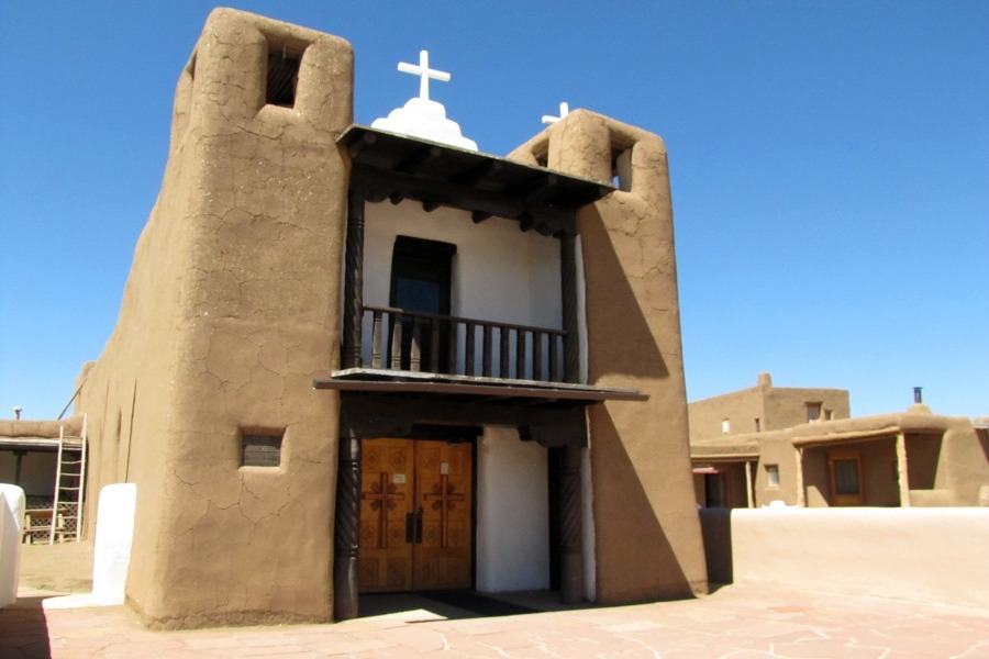
Taos Pueblo is a living Native American community located at the base of the beautiful Sangre de Cristo Mountain range. Archaeologists say that ruins in the Taos Valley indicate the Taos Pueblo people lived here nearly 1000 years ago. The main part of the current pueblo was most likely constructed between 1000 and 1450 A.D. The pueblo appears much as it was when the first Spanish explorers arrived in Northern New Mexico in 1540. The two structures called Hlauuma (north house) and Hlaukwima (south house) are said to be of similar age. They are considered to be the oldest continuously inhabited communities in the USA.
TAOS PUEBLO: Hlauuma (north house).Taos Pueblo Mission Church built in 1726.Taos Pueblo Mission Church built in 1850.Photos by EMKotyk
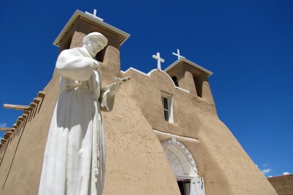
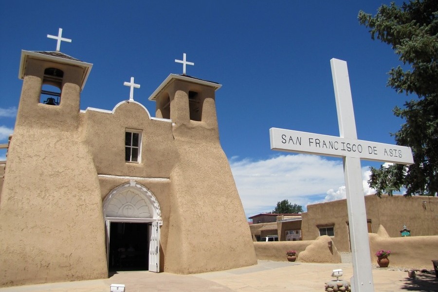
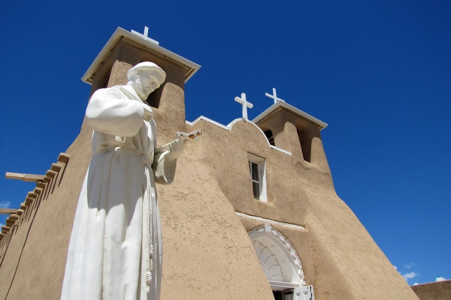
One of the most photographed/painted churches in the United States, San Francisco de Asis is a vibrant Roman Catholic parish in Ranchos de Taos, NM and has stood as a cornerstone of the surrounding faith community since its construction began, perhaps as early as 1772. Completed in 1816, the San Francisco de Assisi Mission Church is a large, sculpted Spanish Colonial church with massive adobe buttresses and two front-facing bell towers.
San Francisco De Asis Mission Church.San Francisco De Asis Mission Church.Photos by EMKotyk
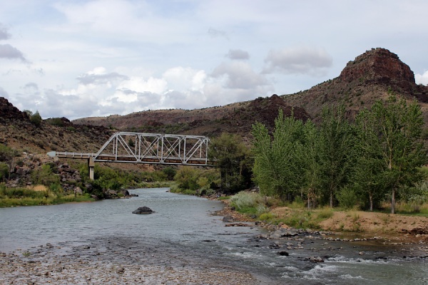
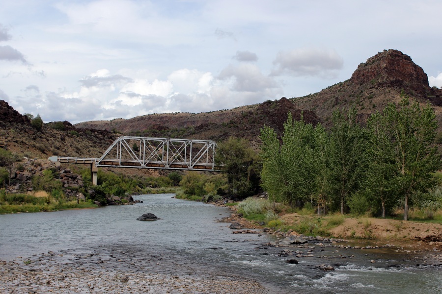
The Rio Grande del Norte National Monument is comprised of rugged, wide open plains dotted by volcanic cones, and cut by steep canyons with rivers. The Rio Grande has carved an 800 foot deep gorge through layers of volcanic basalt flows and ash. Among the volcanic cones in the Monument, Ute Mountain is the highest at 10,093 feet. This area has attracted human activity since prehistoric times. Evidence of ancient use is found throughout the area in the form of petroglyphs, prehistoric dwelling sites, and many other types of archaeological sites. The unique setting of the Monument also provides a wealth of recreational opportunities; whitewater rafting, hunting, fishing, hiking, mountain biking, and camping are some of the most enjoyed activities.
Taos Junction Bridge in southern part of Rio Grande del Norte Monument.Photo by EMKotyk
Angel Fire
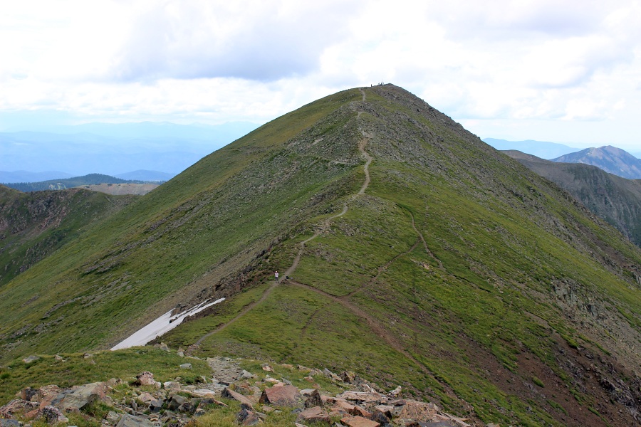
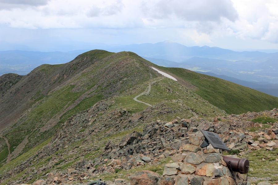
Located in picturesque Moreno Valley, Angel Fire sits on the valley floor at 8,420 feet and the mountains surrounding rising to over 11,000 feet. At the northern end of the valley, Wheeler Peak at 13,161 ft is the highest peak in New Mexico. Winters are action-packed and snow-filled and the summers are refreshingly cool.
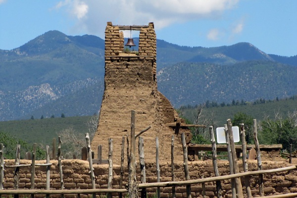
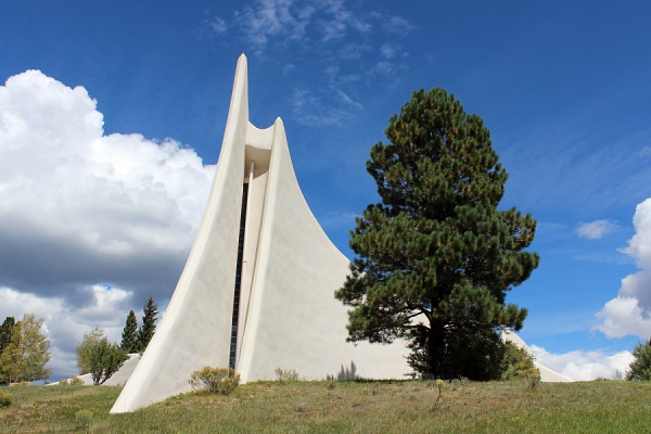
Originally known as the Vietnam Veterans Peace and Brotherhood Chapel, it had its origins in a battle near Con Thien, South Vietnam in which 17 men lost their lives. Among the men, was David Westphall, son of Victor and Jeanne Westphall. Their vision and determination created the memorial that exists today which honors not only these 17 Marines but all members of America's armed forces.
The Chapel at Vietnam Veterans Memorial.Photo by EMKotyk
Eagle Nest
Eagle Nest is a small, summer home community and resort area. Catering to the outdoors, camping, backpacking and hiking are popular activities.
Enchanted Circle Gateway Museum & Visitor Center
The Museum features culture and history exhibits, facilitates tours of historic places, stocks various maps, has a small research library, photographs, and visitor information of area events and activities.
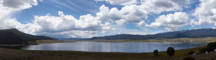
Eagle Nest Lake is surrounded by the stunning scenery of the high mountains of the Moreno Valley. This lake is regularly stocked with trout and salmon. Anglers can fish from the banks or by boat and ice fish in the winter.
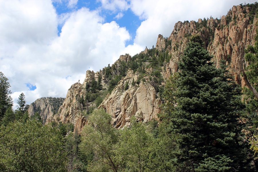
Though not on the Enchanted Circle Scenic Byway, the Palisades Sill is located about 5 miles east of Eagle Nest on U.S. 64 along a nice canyon drive. A sill is a type of igneous rock body that formed from volcanic activity under the earth's surface, intruding between older rock beds. The age of the Palisades Sill has been estimated between 26 million and 34.7 million years. The Cimarron River flowing eastward past the Palisades is well-known for eight miles of excellent trout fishing.
The Palisades.Photo by EMKotyk
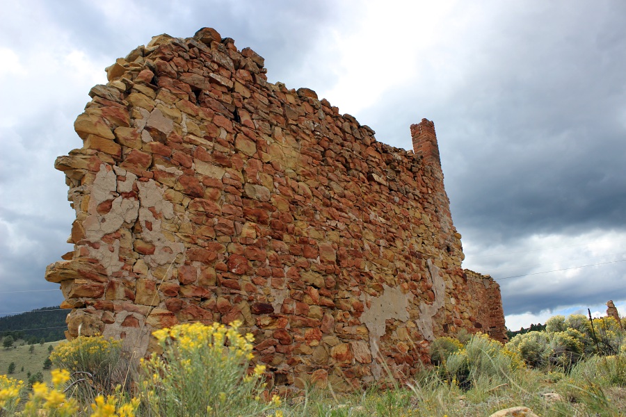
Located 5 miles north of Eagle Nest, Elizabethtown began in 1866 with the founding of area gold mines and the Mystic Copper Mine. It was New Mexico's first incorporated town. Founded by the commander of Fort Union (north of Las Vegas, New Mexico), Captain William H. Moore, and named for his daughter, Elizabeth Catherine Moore. The town grew to over 7,000 residents at its height of prosperity in 1870, and it was designated the first seat of the newly formed Colfax County. In 1872 there were only about 100 residents left as the mines dwindled, and the county seat was moved to Cimarron. The town revived somewhat when the Atchison, Topeka and Santa Fe Railroad passed nearby in the early 1890s, making mining feasible once again. The village was also part of the Colfax County War. A fire took most of the town in 1903, and the town mostly died out by 1917 with the decline in the mines. The one standing stone structure, the Mutz Hotel, contnues to collapse to the extent that the windows are no longer present.
Elizabethtown: Mutz Hotel which continues to collapse.Photo by EMKotyk
Red River
When explorers, fur trappers and prospectors discovered the area they put River City, as Red River was first called, on the map. Hundreds of gold, silver and copper mines were carved into the mountain and the population soared. However, the mines played out eventually, but soon homesteaders outnumbered prospectors. The town gained new momentum by renting abandoned mining cabins to flatland visitors seeking refuge from the heat. In the late 1920s and early 1930s, Red River was designated the "mountain playground" that it is today.
Sitting at 7,500 ft., Questa is the gateway to the Rio Grande del Norte National Monument, and the northern gateway to the Enchanted Circle Scenic Byway that surrounds the highest peak in New Mexico. Questa is one of several small, historic towns that scattered up the Rio Grande from what is now Mexico into southern Colorado in the 18th and 19th centuries. Questa was officially founded in 1842.
The Rio Grande del Norte National Monument is comprised of rugged, wide open plains dotted by volcanic cones, and cut by steep canyons with rivers. The Rio Grande has carved an 800 foot deep gorge through layers of volcanic basalt flows and ash. Among the volcanic cones in the Monument, Ute Mountain is the highest at 10,093 feet. This area has attracted human activity since prehistoric times. Evidence of ancient use is found throughout the area in the form of petroglyphs, prehistoric dwelling sites, and many other types of archaeological sites. The unique setting of the Monument also provides a wealth of recreational opportunities; whitewater rafting, hunting, fishing, hiking, mountain biking, and camping are some of the most enjoyed activities.
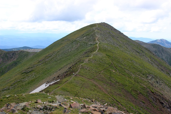
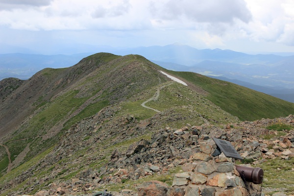
The Village of Taos Ski Valley offers a variety of experiences for your soul to relax and your mind to unwind. In winter ski and snowboard to your heart's content on over 100 trails including expert hike-to terrain and newly updated and graded beginner's runs. In summer hike mountain trails, experience high altitude mountain biking or ride a horse through the wilderness. It is from here that one can hike to Wheeler Peak (13,161 ft) - the highest point in New Mexico.